
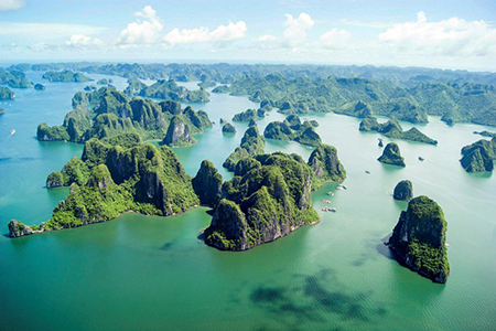
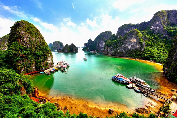
I was thrilled by my discovery in autumn of Yen Hung, a district southwest of the border province of Quang Ninh. It was all by chance. We were on our way to Ha Long Bay on a package tour, then. After we had passed Pha Rung (Forest Ferry) we thought it would be interesting to explore the hinterland.
It's very fortunate that Yen Hung remains almost unknown to the ordinary tourists, who flocked in increasing number to Ha Long this year, the region is dotted with hills and covered with lush paddies, Where it borders on the sea it is fringed with mangrove, which grows in great profusion.
The first thing we discovered was the district town itself, which used to be also the capital of the former province of Quang Yen. The lay of the land is evocative of a woman lying on her back, with one raised knee, hence the name Nui Tien (Fairy Mount). Of the citadel built in the 19th century, the seat of the administration of Quang Yen, very little was left, and that included several rusty cannons.
We spent the night in what used to be the residence of the French provincial governor, in the shade of three big "lim" (ironwood) trees said to be some seven hundred years old, and next to a deep well very clear water, which is called Gieng Tien, or Fairy Well. In 1954, the last units of the French army regrouped at the barracks of Yen Hung before their departure for France.
Ha Nam Island welcomed us with its carpet of emerald paddies enhanced here and there by villages of a darker hue of green. The island has a population of some fifty thousand but boasts a sea dyke of thirty-four kilometres, which testifies to a long history of poldering.
The place was first settled in the 11 th-12 th century by fisher folk, practised rice planting on a small scale under the constant threat of the tide at the mouth of the Bach Dang River which normally is several metres above ground level.
Then, in the middle: of the 17th century, nineteen "Tien Cong" (Ancestors), most of them from the royal capital, came to the island and mobilized locals in a long-haul drive to set up dykes along the coast and reclaim salt marshes for rice cultivation.
The memories of those enterprising men have been perpetuated to these day by a grateful population, who will celebrate, on the Seventh Day of the First Month, the discovery of the first source of fresh water on the island.
Another ceremony, performed only by men of eighty or older, consists in parading with four lumps of earth which, at the end of the procession, will be placed on the altar by four patriachs, who will then stage a mock wrestling bout.
Each of the seven villages on the island has its own communal house, dedicated to great people of the pioneering days.
The one at Phong Coc is for the worship of the Four Saints - a Chinese empress and her three sons of the Sung dynasty who ran away from Mongolian invaders and perished at sea. It is an architectural gem, with its immense ancient tile roof, its huge wooden pillars and its intricate wood sculptures.
From Phong Coc we went to see vestiges of (he famous Bach Dang Battle in 1288 when the Vietnamese army sank a 400-strong fleet together with 40,000 troops of the Mongolian invasion forces.
General Tran Hung Dao, whose name has been given to streets in many cities, lured the invasion fleet into the Bach Dang at flood tide after having planted huge iron-tipped wooden spikes into the riverbed. At ebb tide the enemy, attacked on all sides, withdrew with haste to the sea, only to be impaled on the deadly stakes, which were first discovered in 1953 by people who were strengthening a portion of the dyke in Yen Giang.
Tran Hung Dao is worshipped in a nearby temple. We can see him there in the form of a highly original statue: the famed general is knotting his hair into a bunch at the nape of his neck.
Not far away is another temple, built in the memory of a tea vendor on the bank of the Chanh River who gave Tran Hung Dao valuable information on terrain and tide movements.