Phnom Penh to Ho Chi Minh
This international ride offers an alternative route to Vietnam for those who want to see a little more of Cambodia along the way. Those who don’t have time to take in the charms of Kompong Cham and Prey Veng can go directly from Phnom Penh to Saigon along National Hwy I in three days, overnighting in Neak Loung and Svay Rieng.
The old road to Kompong Cham along the Mekong is extremely beautiful and relatively traffic-free. However, it is long, with Day 1 the toughest. Passing through rubber country to Prey Veng, the route rejoins busy National Hwy 1 to Svay Rieng. Once over the border in Vietnam, a nice loop to the Caodai temple of Long Hoa avoids some of the traffic hurtling towards Ho Chi Minh City. Unfortunately, it can’t be dodged forever and the last 30km into the commercial capital of the south is nerve-wracking in the extreme.
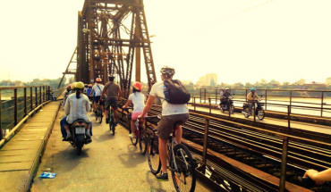
Many nice loops on international bike tour from Phnom Penh to Ho Chi Minh city
History
Much of eastern Cambodia was turned into rubber plantations during the French period, particularly parts of Kompong Cham and Prey Veng provinces. These industries are struggling to re-establish themselves after years of neglect during the war. Svay Rieng and Prey Veng have also traditionally been some of Cambodia’s poorest provinces, subject to the vagaries of drought and flooding. During the Khmer Rouge rule of the 1970s, the people in this area were subjected to especially vicious persecution, as they were considered tainted by Vietnamese influence.
Over in Vietnam, the French and Americans had particular trouble suppressing communist insurgents in the Tay Ninh area because of the coverage afforded them by the massive rubber plantations. Viet Cong operatives also had the protection of the Cambodian border nearby, and many were able to evade capture or death by slipping into the so-called parrot’s beak, the jut of land where Svay Rieng province extends to- wards Saigon.
When to Ride
This ride is easiest in the dry season, as several sections of the route involve dirt roads. However, it can also be done in the wet season by staying on National Hwys 6 and 7 to Kompong Cham and following the rest of the ride from there.
Day 1: Phnom Penh to Kompong Cham
7-8 hours, 110.6km
This is a long day, but the route passes some hidden rural communities that few tourists ever see. The locals will be delighted to see the crazy barang on a road to nowhere, but Kompong Cham has good enough facilities to ensure the gain outweighs the pain.
The hustle and bustle of Phnom Penh gives way to the slow pace of rural life after the Japanese Friendship Bridge. The sculpture at S.3km was made from melted-down firearms confiscated in an illegal weapons clampdown in 1999. Huts cling to the roadside, punctuating the views of endless paddy fields.
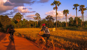
Explore the Cham country by cycling trip.
This is Cham country, home to Cambodia’s minority Muslim community; along the way there are several small mosques, rebuilt after brutal treatment by the Khmer Rouge. At the fork at 40.6km the season is likely to dictate the direction taken fit is the wet season or there have been recent heavy rains, it is wise to stick on the tarmac and follow the main road to Kompong Cham via Skuon. However, if it is dry, then adventure beckons down the right fork, the route covered here.
The dirt road is reasonably flat as long as you stick to the side trails carved out by locals on bikes and motos. Passing through the small town of Koh Kaong (42.9km), a good spot for lunch, the road runs into the massive Mekong River at about 48km. From here the river is a constant, if intermittent, companion until Kompong Cham. Several small villages have supplies, including Klok Chrou (71 km), which has quite a few shake and juice stalls with basic food.
The latter stages of the ride pass by many beautiful wats and the riverside town of Kang Meas, a good final refreshment stop.
Kompong Cham
Cambodia’s third largest town was very important during the French protectorate, serving as a major port on the Mekong and the centre of the massive rubber industry. Today, like the rubber industry, the city hopes to revive its former glories. A massive bridge is under construction over the Mekong, which will make the town a major transit point on the Bangkok-Ho Chi Minh City road.
Day 2: Kompong Cham to Prey Veng
4-5 hours, 78.5km
This pleasant route has little traffic, even by Cambodian standards. The ferry over the Mekong should be replaced by a Japanese- funded bridge by 2002, which will slightly change the route out of town at 500m. If you’re traveling on the ferry, look out for some of the more aggressive beggars; they may try to privatize parts of your bicycle.
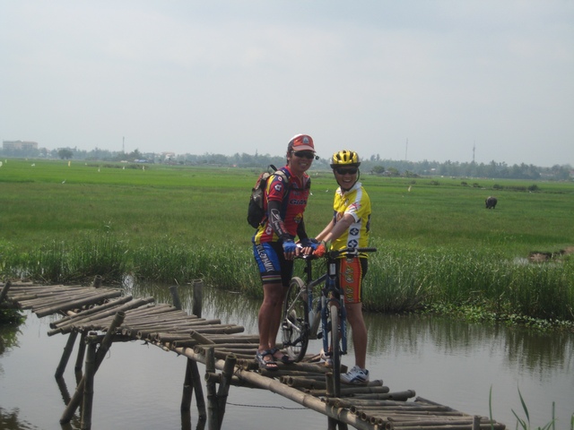
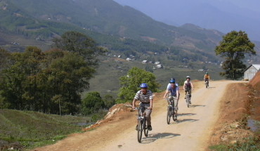
There are many bridges and roads over Mekong river on your cycling trip.
Across the Mekong, the tarmac gives way to dirt and shale. Once on Hwy 15 (l3.6km), the road is flat but very uneven in patches; stick to the narrow tracks on the edge. Much of the first half of the ride passes through rubber plantations; myriad tracks disappear into the plantations and friendly locals weave back and forth. The small town of 0 Riang Au (32.9km) makes a good meal stop as it is about the largest settlement encountered along the way. From here, the road improves considerably and is surfaced. The road is elevated above the surrounding paddy fields and it is flat, freewheeling country.
Svay Antor (62km) makes a convenient stop for a final drink. The ride ends at Prey Veng’s central roundabout, beside the Mittapheap Guesthouse.
Prey Veng
This is undoubtedly Cambodia’s sleepiest provincial capital, not because of any lack of enthusiasm on the part of its citizens but because of its inconvenient location away from the major highways. It is a small, handsome town with an air of neglect, and not a tourist in sight.
There are no banks for changing money. Look for bike repairers around the small market.
Day 3: Prey Veng to Svay Rieng
6-7 hours, 102.5km
This could be considered the most grueling ride of the trip, but it is not all bad news. By the time you read this, National Hwy 1 (from Neak Loung) should have been completely renovated and as good as any road in the country.
Leaving the serenity of somnolent Prey Veng, the road soon deteriorates as many sections have simply fallen away during the wet season; in many places the road is littered with potholes.
This is one of the quieter parts of the ride and although there are a few tiny villages, carry a few liters of water just to be sure. When the Mekong appears at 30km, Neak Loung is nearing. This port was immortalized in The Killing Fields – the film’s first scene depicts the ‘accidental’ bombing of the town in 1973. Today the town is a thriving, if uninspiring, transport hub. It is a good place to get fed and watered.
Several villages on the highway have supplies, including Kompong Soeung (43.5km), Kompong Trabek (62.6km) and Krol Ko (78.7km). The scenery varies with the season: in the wet the surrounding area is quilted in a dazzling array of greens, but in the dry season it is barren and bland.
Svay Rieng
The eponymous capital of one of Cambodia’s poorest provinces, this is also the gateway to the parrot’s beak, a strip of Cambodian territory that juts out towards Ho Chi Minh City, an area that was an obsession to successive US military commanders in Vietnam who were convinced it was where the communists had their version of the Pentagon. Today, it’s a quiet backwater hoping for a boom once National Hwy 1 is upgraded. The Tonle Waykor flows through the town centre.
There are no banks for foreign exchange, but hotels and market stalls can exchange US dollars for riel. Bike shops are in the area around the market.
Day 4: Svay Rieng to Long Hoa (Vietnam)
6-7 hours, 94.1 km
This is an international ride crossing the border between Cambodia and Vietnam, so have your documents ready and smarten up a little to avoid being hassled by immigration officials. Along the way to the border town of Bavet, the small towns of Prasout (10.2km) and Chiphu (23.7km) have drinks and snacks places. At the border itself (41.7km), there is a small restaurant with reasonable prices and an international telephone service, both useful for those needing to dispense with riel.
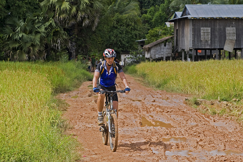
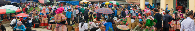
Bicycle trip in Vietnam-Cambodia border offer many challenges on unique roads.
Crossing the border should be stress free as long as the paperwork is in order. On the Vietnamese side there is a small cafe offering meals and drinks, and some moneychangers willing to exchange US dollars for dong.
The most immediate contrast between Vietnam and Cambodia is the headgear: kramas for Khmers and conical hats for Vietnamese. However, during the dry sea- son, there are starker contrasts still in the landscape. Much of Cambodia’s irrigation system is incapacitated after years of destruction and decay, but Vietnam’s is flourishing, allowing the farmers to produce more than one rice harvest a year. The contrast in colour is incredible: Cambodia looks like the Gobi Desert and Vietnam is a riot of green.
The road from the border is in reasonable condition and traffic is light by Vietnamese standards (denser than in Cambodia). Go Dau (51.9km) marks the point to turn north for Long Hoa and Tay Ninh, and is a useful place to get food and drink. The road north is in fine condition and offers incredible views across the lush countryside; the size of Nui Ba Den (Black Lady Mtn; 850m high) indicates how far it is to Long Hoa. The small cafe (72.7km) is regularly favored by backpacker tours and offers fruit shakes and pancakes that may be craved after a few days off the trail. The final stages of the ride wind through the Caodai Holy See, the incredible cotton-candy administration centre of the Caodai religion.
Long Hoa
This village serves as the headquarters of one of Vietnam’s most interesting indigenous religions, Caodaism. Tay Ninh, the capital of Tay Ninh province, is 4km west. Come with a steady supply of US dollars and dong as there are no useful banks here or in Tay Ninh.
Things to See & Do The Caodai Great Temple, within the Holy See complex, looks like the collision of a cathedral and a Hans Christian Andersen fairy-tale. Built between 1933 and 1955, it is almost candy- coated and bursting with colour. It is possible to visit this temple throughout the day, but many prefer to time their visit with the 6am, noon or 6pm services.
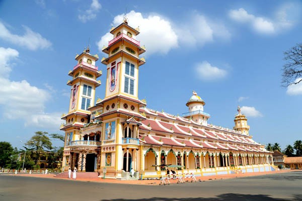
Cao Dai Temple, Tay Ninh province
Caodaism is the product of an attempt to create the ideal religion through the fusion of secular and religious philosophies from both East and West. The result is a colorful and eclectic potpourri that includes bits and pieces of Buddhism, Confucianism, Taoism, Hinduism, native Vietnamese spiritualism, Christianity and Islam (see also Religion in the Vietnam chapter). Victor Hugo is among the Westerners especially revered by the Caodai; look for his likeness at the Great Temple.
Visible from all over the surrounding area is Nui Ba Den, 15km north-east of town. This mountain shrine is sacred not only to the Vietnamese, but also to Chams, Chinese and Khmers. It’s a healthy 11/2.-hour walk to the main temple complex, or take the cable car.
Day 5: Long Hoa to Ho Chi Minh City
6-7 hours, 91.5km
After four days in the proverbial sticks, it is time for the bright lights and big city, and Ho Chi Minh City is one of Asia’s best. However, first there is the small challenge of overcoming the incredible volume of traffic that develops near the city limits.
The first half of the ride is pleasant, as the route takes a minor road, one of the quietest anywhere in the country. The road winds away from Nui Ba Den through attractive farming communities and verdant country- side. There is almost continuous inhabitation along this stretch and refreshment is never far away. Just after Trang Bang (43.1 km), a reasonable food stop, the traffic volume increases tenfold and the road is only slightly wider.
Cu Chi (58.7krn) is a gateway to what was one of the most infamous regions of Vietnam during the Vietnam War. The tunnel network of Cu Chi District became legendary during the 1960s for its role in facilitating Viet Cong control of a large area only 30krn from Ho Chi Minh City. At its height the tunnel system stretched from Saigon to the Cambodian border. In Cu Chi District alone, there were more than 200km of tunnels. As ground operations against the tunnels sustained significant US casualties and proved ineffective, US forces turned their artillery and bombers on the area, turning it into a moonscape. It is too far from the main road to realistically undertake as a side trip from the ride, but is well worth a day trip from Ho Chi Minh City.
From Cu Chi into Ho Chi Minh City is more than 30krn of fumes, horns and general chaos. Keeping your eyes wide open, fixed on the road ahead, and hugging the right shoulder is the easiest way to survive … Ho Chi Minh City awaits, a city that is going places, but with enough class not to bury the past along the way.
Click here for more infomation about Vietnam Cycling Tours and Cambodia Cycling Tours.