The far south is studded with wonderful attractions: from pristine jungle scenery to the cooler Bolaven Plateau and the rambling ruins of Wat Phou, once an important regional powerbase.
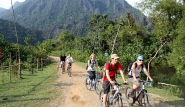
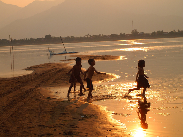
The true gems of the south, however, are the Siphandon (4000 islands), lush green islets that offer the perfect setting for those wanting to kick back for a few days. This region, near the border with Cambodia, is an idyllic picture-perfect ending to any trip in Laos. The three main islands offer something for all tourists: the larger Don Khong is great for exploring and taking in the stunning vista and traditional Lao rural life; Don Deth is a backpacker haven and is ideal for those who want to while away the days in a hammock with a good book; and Don Khone is better for tourist sites such as the Li Phi falls or old colonial ruins. There are roaring waterfalls nearby and pakha (freshwater dolphins), can sometimes be spotted here between December and May.
Pakse (Champasak)
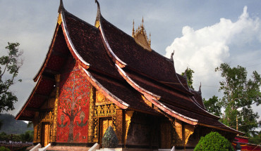
Vat Phou Temples in Pakse, Laos
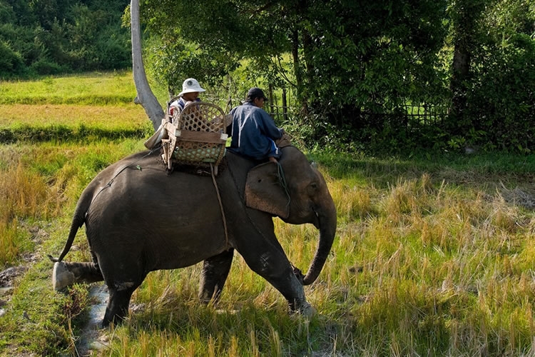
Pakse is the largest town in the south and is strategically located at the junction of the Mekong and Xe Don rivers. It is a busy commercial town, built by the French early in the 20th century as an administrative centre for the south. The town has seen better days but the tatty colonial buildings lend an air of old-world charm. Pakse is a major staging post for destinations further afield such as the old royal capital ofChampasak, famed for its pre- Angkor, seventh-century Khmer ruins of Wat Phou. Close to Pakse are ecotourism projects where elephant treks, birdwatching and homestays are possible.
Arriving Pakse
Getting there Pakse is Southern Laos’ transport hub. The upgraded airport is 2 km northwest of town; tuk-tuks will make the journey. International flights from Bangkok, Phnom Penh, Siem Reap, and Ho Chi Minh City as well as domestic flights to/from Vientiane, Savannakhet and Luang Prabang run several times a week.
There are three official bus terminals in Pakse: the Northern terminal (Km 7 on Route 13 north) is for buses to and from the north; the Southern terminal (Km 8 south on Route 13) is for buses to and from the south; and the VIP Khiang Kai and international bus terminal (with neighbouring Seangchaolearn terminal) is for northbound VIP buses. VIP buses to Ubon in Thailand are available from the evening market; and a new daily service from Bangkok has launched. Laos visas are available on arrival at the Chongmek border crossing if you’re coming in from Thailand but don’t expect the bus to wait for you. Tuk-tuks wait to transport passengers from terminals to the town centre.
Elephant Riding in Champasak, Laos
Getting around The main tuk-tuk ‘terminal’ is at the Daoheung market. Cars, motorbikes and bicycles are available for hire from some hotels and tour companies. The town’s roads are numbered as if they were highways: No 1 road through to No 46 road and are laid out diagonally.
Champasak and around
The small, attractive agricultural town of Champasak, which stretches along the right bank of the Mekong for 4 km, is the nearest town to Wat Phou and with enough comfortable accommodation, is a good base from which to explore the site and the surrounding area. It is about 40 km south of Pakse. The sleepy town is quaint and charming and a fantastic place to spend the night, though the trip can be done in a day. The town itself is dotted with simply stunning colonial buildings. Of these, the former residence of Champasak hereditary Prince Boun Oun and former leader of the right wing opposition, who fled the country in 1975 after the Communist takeover, is quite possibly the most magnificent colonial building in Laos. His daughter-in-law now resides there and although it is not open to tourists it is certainly worth a look from the outside. Champasak is known for its wood handicrafts, and vases, and other carved ornaments are available for sale near the jetty.
Arriving in Champasak
Wat Phou temple
Wat Phou The site is officially open now cryptically list ‘overtime hours’ from 06:30 and if staff are present they may be happy to let you in if or sunrise, even as early as 05:30, and you won’t get thrown out until 18:00. A new bus service that must rank as the most expensive per metre in Southeast Asia is now available to transport visitors the 500 m from the gate to the main. Close to the main gate is the Wat Phou Museum at the entrance, with a surprisingly good collection of artifacts such as the garuda and nandi bull. From the Champasak dock, you can catch a tuk-tuk to Wat Phou, 8-9 km. Most people prefer to hire a bicycle from one of the guesthouses in Champasak town and cycle to the ruins. Guides can now be arranged. There are several restaurants within the vicinity of the site. A new full moon event has been launched at Wat Phou, an atmospheric exploration of the site with lights from 18:00-21:00.
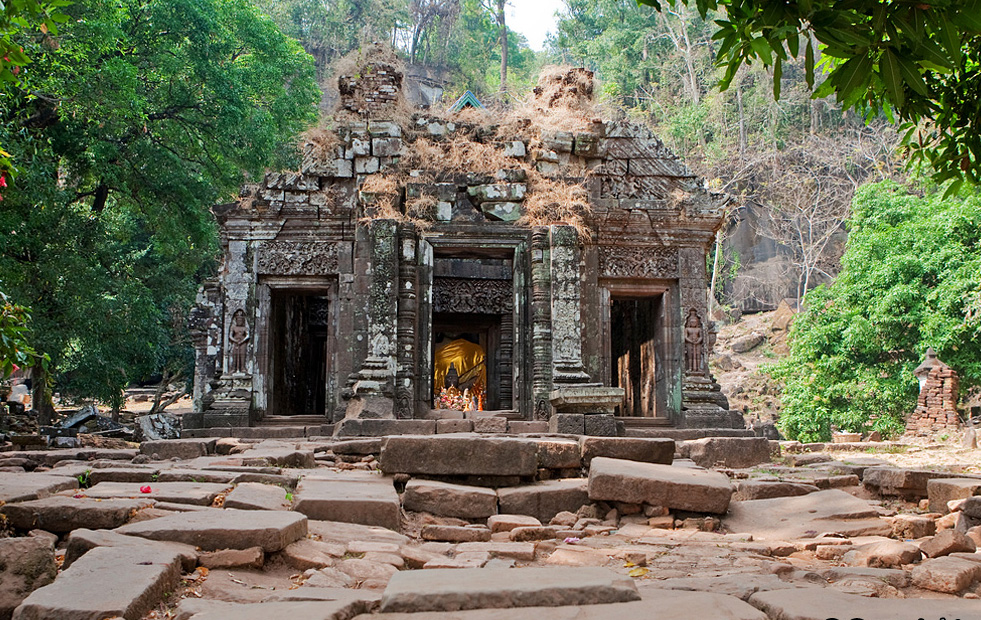
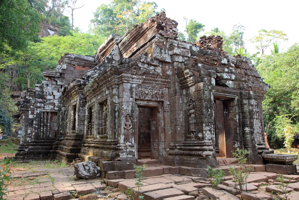
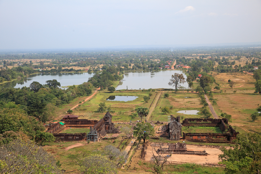
The archaeological site of Wat Phou is at the foot of the Phou Pasak, 8 km southwest of Champasak. With its teetering, weathered masonry, it conforms exactly to the Western ideal of the lost city. The mountain behind Wat Phou is called Linga Parvata, as the Hindu Khmers thought the protrusion from its peak resembled a linga – albeit a strangely proportioned one. Although the original Hindu temple complex was built in the fifth and sixth centuries, most of what remains today is believed to have been built in the 10th to 11th centuries.
Wat Phou was a work in progress and was constructed and renovated over a period spanning several hundred years. Most of the ruins date back to the fifth and sixth centuries, making them at least 200 years older than Angkor Wat. At that time, the Champasak area was the centre of power on the lower Mekong. The Hindu temple only became a Buddhist shrine in later centuries.
Archaeologists and historians believe most of the building at Wat Phou was the work of the Khmer king, Suryavarman II (1131-1150), who was also responsible for starting work on Angkor Wat in Cambodia. The temple remained important for Khmer kings even after they had moved their capital to Angkor. They continued to appoint priests to serve at Wat Phou and sent money to maintain the temple until the last days of the Angkor Empire.
Wat Phou temple and landscape in Laos
Exploring the site The king and dignitaries would originally have sat on a platform above the ‘tanks’ or baray and presided over official ceremonies or watched aquatic games. In 1959 a palace was built on the platform so the king had somewhere to stay during the annual Wat Phou Festival. A long avenue leads from the platform to the pavilions. This processional causeway was probably built by Khmer King Jayavarman VI (1080-1107) and may have been the inspiration for a similar causeway at Angkor Wat.
The sandstone pavilions, on either side of the processional causeway, were added after the main temple and are thought to date from the 12th century. Although crumbling, with great slabs of laterite and collapsed lintels lying around, both pavilions are remarkably intact. The pavilions were probably used for segregated worship by pilgrims, one for women (left) and the other for men (right). The porticoes of the two huge buildings face each other. The roofs were thought originally to have been poorly constructed with thin stone slabs on a wooden beam-frame and later replaced by Khmer tiles. Only the outer walls now remain but there is enough still standing to fire the imagination: the detailed carving around the window frames and porticoes is well-preserved. The laterite used to build the complex was brought from Ou Mong, also called Tomo Temple, another smaller Khmer temple complex a few kilometres downriver, but the carving is in sandstone. The interiors were without permanent partitions, although it is thought that rush matting was used instead, and furniture was limited – reliefs only depict low stools and couches. At the rear of the women’s pavilion are the remains of a brick construction, believed to have been the queen’s quarters.
Above the pavilions is a small temple, the Nandi Pavilion, with entrances on two sides. It is dedicated to Nandi, the bull (Siva’s vehicle), and is a common feature in Hindu temple complexes. There are three chambers, each of which would originally have contained statues – these have been stolen. As the hill begins to rise above the Nandi temple, the remains of six brick temples follow the contours, with three on each side of the pathway. All six are completely ruined and their function is unclear. At the bottom of the steps is a portico and statue of the founder of Wat Phou, Pranga Khommatha.
The main sanctuary, 90 m up the hillside and orientated east-west, was originally dedicated to Siva. The rear section (behind the Buddha statue) is part of the original sixth- century brick building. Sacred spring water was channelled through the hole in the back wall of this section and used to wash the sacred linga. The water was then thrown out, down a chute in the right wall, where it was collected in a receptacle. Pilgrims would then wash in the holy water. The front of the temple was constructed later, probably in the eighth to ninth century, and has some fantastic carvings: apsaras, dancing Vishnu, Indra on a three-headed elephant and, above the portico of the left entrance, a carving of Siva, the destroyer, tearing a woman in two.
The Hindu temple was converted into a Buddhist shrine, either in the 13th century during the reign of the Khmer king Jayavarman VII or when the Lao conquered the area in the 14th century. A large Buddha statue now presides over its interior.
Don Daeng Island
Children in Don Daeng Island, Laos
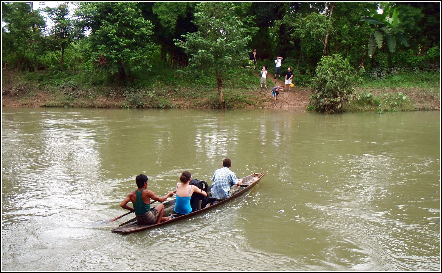
This idyllic river island sits right across from Champasak. It stretches for 8 km and is the perfect place for those wishing to see quintessential village life, with basket weaving, fishing and rice farming, and without the cars and hustle and bustle.There is a path around the island that can be traversed on foot or by bicycle. A crumbling ancient brick stupa, built in the same century as Wat Phu, is in the centre of the island and there are a few ancient remnants in Sisak Village from the construction. The local inhabitants of Pouylao Village are known for their knife-making prowess. There is a lovely sandy beach on the Champasak side of the island, perfect for a dip. The island hasn’t been welcoming tourists for long, so it is important to tread lightly. There is one upmarket hotel on the island and homestays can be arranged from the tourist offices in Pakse or Champasak.
Xe Pian National Protected Area
Boating in Xe Pian National park, Laos
The Xe Pian National Protected Area (NPA) is home to large water birds, great hornbills, sun bears, Asiatic black bears and the yellow-cheeked crested gibbon. The area is rich in bird-life and is one of the most threatened land-types in Laos. Ban Kiet Ngong Village, 1’/2 hours from Pakse, has a community-based project offering elephant trekking and homestay accommodation on the edge of the Xe Pian NPA. The village itself is at the Kiet Ngong Wetland, the largest wetland in southern Laos. The villagers have traditionally been dependent on elephants for agricultural work and their treks can be organized to either the Xe Pian National Protected Area or the amazing fortress of Phu Asa. This ancient fortress is located 2 km from Kiet Ngong, at the summit of a small jungle-clad hill. It is an enigmatic site that has left archaeologists puzzled; it consists of 20 stone columns, 2 m high, arranged in a semi-circle – they look a bit like a scaled-down version of Stonehenge.
To reach the village from Pakse, follow Route 13 until you get to the Km 48 junction with Route 18 at Thang Beng Village (the Xe Pian National Protected Area office is here). Follow route 18 east for 7 km, turn right at the signpost for the last 1.5 km to Ban Kiet Ngong.
There are several other two- to three-day trekking/home stay ecotours offered in the area and camping is also now available, from one to three nights; contact the Provincial Tourism Information Office, Green Discovery in Pakse, the Kingfisher Ecolodge, or book direct via www.xepian.org.
Bolaven Plateau
Tourist village water fall in Bolaven Plateau, South of Laos
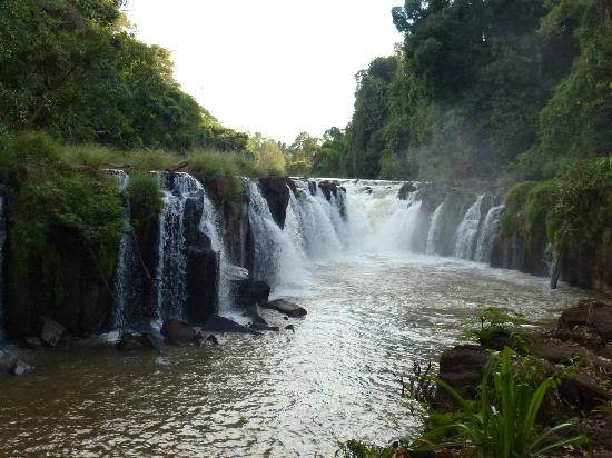
The French identified the Bolaven Plateau, in the northeast of Champasak Province, as a prime location for settlement by hardy French farming stock. It is named after the Laven minority group that resides in the area. The soils are rich and the upland position affords some relief from the summer heat of the lowlands. However, their grand colonial plans came to naught and, although some French families came to live here, they were few in number and all left between the 1950s and 1970s as conditions in the area deteriorated. Today the plateau is inhabited by a mix of ethnic groups, such as the Laven, Alak, Tahoy and Suay, many of whom were displaced during the war. The premier attraction in the area is the number of roaring falls plunging off the plateau; Tad Lo andTad Fan are particularly popular tourist destinations, while the grand Tad Yeung makes a perfect picnic destination. The plateau also affords excellent rafting and kayaking trips.
Paksong (Pakxong) and around
Bridge in Paksong, Laos
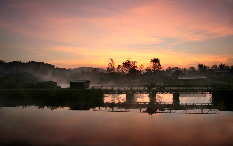
The main town on the Bolaven Plateau is Paksong, a small town 50 km east of Pakse renowned for its large produce market. It was originally a French agricultural centre, popular during the colonial era for its cooler temperatures. The town occupies a very scenic spot, however, the harsh weather in the rainy season changes rapidly making it difficult to plan trips around the area.
On the way to Paksong, just past Km 38, is Tad Fan (5000 kip), a dramatic 120-m-high waterfall, which is believed to be one of the tallest cascades in the country. The fall splits into two powerful streams roaring over the edge of the cliff and plummeting into the pool below, with mist and vapour shrouding views from above.